
Weather satellites helped rescuers save 52 lives in Florida
![]() APP Weather Stories, Florida, Meteorologist Nick Merianos, Orlando, Tampa, Weather Blog Florida NEW, Weather Stories, WX Tracking
0 Comments
APP Weather Stories, Florida, Meteorologist Nick Merianos, Orlando, Tampa, Weather Blog Florida NEW, Weather Stories, WX Tracking
0 Comments
Weather satellites helped rescuers locate and save 330 lives across the country in 2021. More people were rescued in Florida with the help of satellites compared to any other state in the Lower 48.
Advancements in weather satellite technology not only improve weather forecasting but also save lives. The satellites helped rescue 330 people from potential life-threatening situations through the United States and its surrounding waters.
Rescue map detailing where satellites were used to rescue those in distress. (NESDIS and NOAA)
More people were rescued from Florida than any other state in the Lower 48 at 52 rescues. Alaska reported the most rescues aided by satellites at 55.
Out of the 330 U.S. rescues, 195 were water rescues, 29 were from aviation incidents and 106 were from events on land.
Satellites detect distress signals from emergency beacons. Some of these are handheld beacons and are relatively inexpensive. An emergency beacon is great to have when venturing out into hard-to-access areas such as the mountains or on the water, and it can save your life.
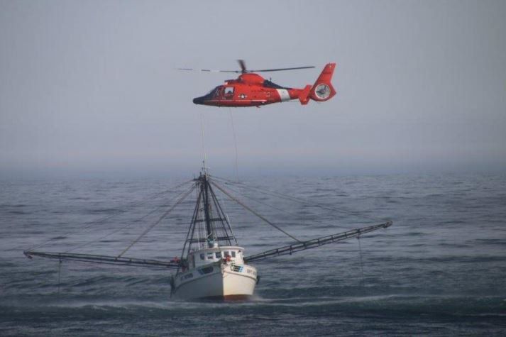
United States Coast Guard rescue boaters in distress. (United States Coast Guard)
Meteorologist Nick Merianos has owned one for a few years now. When Merianos lived in Colorado, he would pack it while hiking in the Rocky Mountains. If he found himself in trouble, all he had to do was activate the beacon. Satellites would detect the distress signal and rescuers would be able to locate him quickly in the event of an emergency.

Meteorologist Nick Merianos takes his personal locator beacon while hiking in the Rocky Mountains or piloting a small aircraft. In the event of an emergency, rescuers will know his exact location using satellite technology.
Using satellites to detect and locate people in distress is not anything new. The idea started in 1982 through a program known as COSPAS-SARSAT. That stands for Search and Rescue Aided Tracking. It uses NOAA’s polar-orbiting and geostationary satellites, along with a network of U.S. and international spacecraft, to detect and locate distress signals coming from emergency beacons.
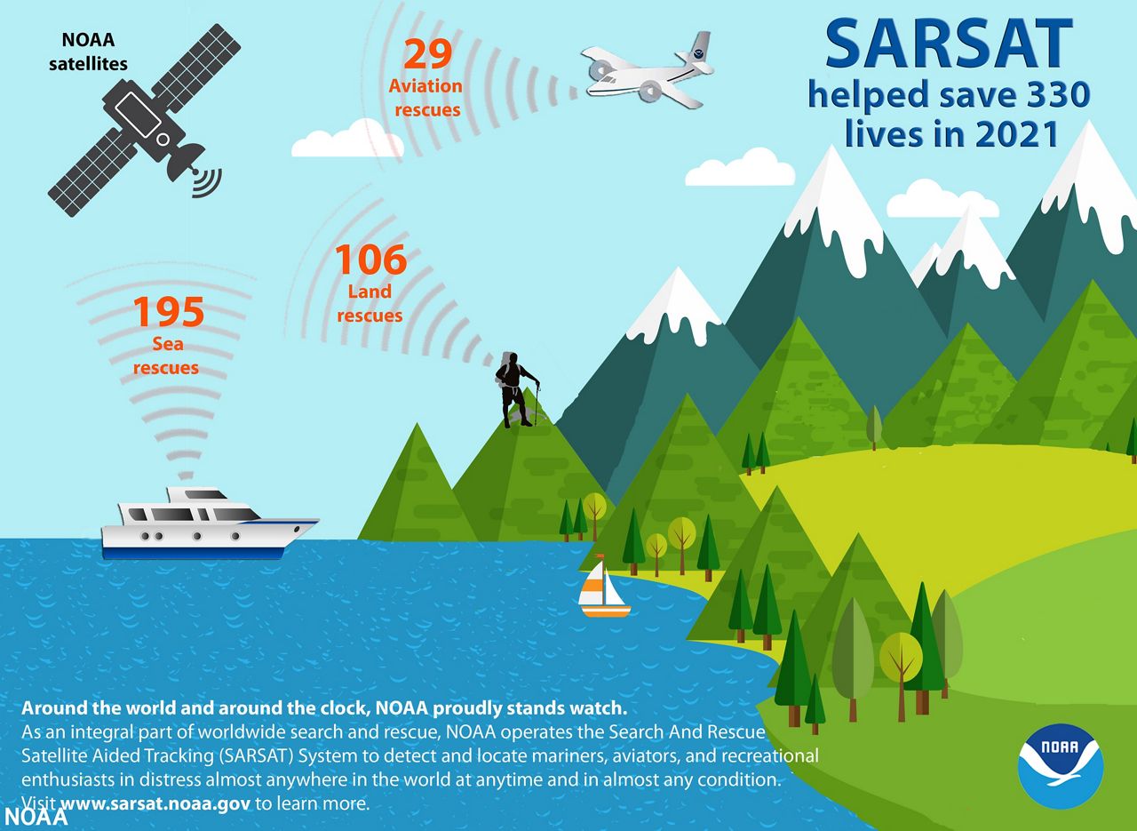
Infographic illustrating the use of beacons for satellite-aided rescues. (NOAA)
When a beacon sends out a distress signal, NOAA satellites help pinpoint the location of the signal, then relays that information to the SARSAT Mission Control Center, located at NOAA’s Satellite Operation Center in Suitland, Maryland. The information is then sent to rescue coordination centers such as the U.S. Air Force for land rescues or the U.S. Coast Guard for water rescues.
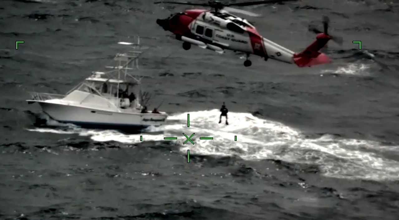
U.S. Coast Guard uses SARSAT to locate and rescue people in distress off Cape May, N.J. (United States Coast Guard)
Since the program launched in 1982, more than 48,000 rescues have been performed worldwide, including more than 9,700 in the United States and its coastal waters.