There are two fish ladders along the Mill Creek Channel: one at the Division Works – the yellow bridge near the project office – and one at the Diversion Dam, just across the river from Rooks Park.
The fish ladder at the Division Works was updated in 2020. Now, work is underway to construct a new fish ladder at the Diversion Dam.
The current fish ladder at the Diversion Dam was built in 1982 and does not meet the current criteria that define a successful fish ladder.
A fish ladder is a series of steps or slots that fish can navigate to “climb” past a dam or other structure in the river. The effectiveness of a fish ladder depends on many factors including the width of the ladder, the amount of water flow and the height of each step. These factors determine how difficult a ladder may be for fish to climb.
At the Diversion Dam, the plan is to design a fish ladder that is wider and has more steps than the current ladder. This would make the ladder easier for fish to navigate and would meet the criteria set by NOAA Fisheries standards. The current fish ladder exposes fish to turbulence and high velocities, which raises concerns for steelhead, Chinook salmon and bull trout returning to spawn in Mill Creek.
“The new fish ladder will have improved attraction flow and passage through the ladder itself, significantly reducing the amount of time fish will not be able to pass the Diversion Dam and reach spawning habitat in the upper Mill Creek.” Fish Biologist Chris Peery said.
Additionally, a channel would be built next to the ladder to allow easy passage for juveniles traveling downstream. There are also plans to construct a low-flow channel to prevent fish from being trapped in the stilling basin directly in front of the dam when there is very little water in Mill Creek.
“It’s a complex project and a great opportunity to partner with other agencies to improve conditions for the fish,” Project Manager Karen Robison said.
The Walla Walla District is working with the Washington Department of Fish and Wildlife, NOAA Fisheries, local tribes and the Tri-state Steelheaders, to develop the new fish ladder.
The project is still in the initial design phases. The new ladder is expected to be built on the opposite side of the river from the current fish ladder. This would put it on the same side of the river as Rooks Park.
The National Oceanic and Atmospheric Administration launched GOES-T, the third in its series of advanced geostationary weather satellites, at 4:38 p.m. ET on March 1 from Cape Canaveral, Florida.
Once the satellite is in orbit, it will be renamed GOES-18 and monitor weather that impacts the western United States, Alaska, Hawaii, Mexico, Central America and the Pacific Ocean.
The satellite will provide our most sophisticated and sharpest look yet at what Earth’s Western Hemisphere looks like from 22,236 miles (35,785 kilometers) above the planet.
GOES-T is equipped with a suite of instruments that can provide measurements of the atmosphere, map lightning in real time and send back stunning ultra high-definition images. Its continuous collection of data will improve weather forecasting on Earth.
Together with the GOES-16 satellite, which launched in 2016, the two will actively monitor more than half the globe, spanning from the west coast of Africa to New Zealand.
“The observations from these satellites are even more critical now, when the US is experiencing a record number of billion-dollar disasters,” said Pam Sullivan, director of NOAA’s GOES-R program, during a press conference. “Compared to the previous generation, GOES-R satellites deliver 60 times more imagery, and they have a new lightning camera to track severe storms that spawn tornadoes and damaging winds.”
The northeastern part of the Pacific Ocean is where many of the storms that impact the US begin.
“Since many of the weather systems of the United States move from west to east, GOES-T will improve model forecasts for the entire country,” said James Yoe, chief administrative officer for the Joint Center for Satellite Data Assimilation, during a press conference on Tuesday.
And it’s not just reporting back weather on Earth — GOES-18 will also keep an eye on solar storms and space weather, providing early warnings ahead of any possible disruptions to our power grid on Earth.
Tracking dangerous conditions
Flooding and mudslides in coastal areas can often be traced to a type of weather phenomena called atmospheric rivers. These “rivers in the sky” deliver columns of water vapor from the tropics and release rain or snow when they make landfall, according to NOAA. Hurricanes that form in the Pacific can spin toward Hawaii or Mexico.
The GOES-T satellite will provide better monitoring of both types of weather events.
Warm ocean surface temperatures can contribute to the formation of hurricanes, so the satellite’s monitoring of these increases could provide early warning about hurricane formation.
The satellite’s capabilities will also help weather forecasters track and monitor tropical storms and hurricanes practically in real time, sharing data about the storm’s structure and features, wind speeds, and lightning. All of these factors can be used to calculate the intensity of a storm.
Tracking rising ocean temperatures can also allow for better monitoring of marine heat waves that cause coral bleaching events en masse and alter entire marine ecosystems.
Wildfires are another hazard for those living in much of the western US, and GOES-18 is armed with a multitude of ways to spot and peer inside the destructive nature of these extreme events.
The satellite will be able to find wildfire hot spots, detect changes in the behavior of the fire, and predict its motion, as well as estimate the intensity, smoke output and air quality. It will also have the accuracy to identify the lightning strikes most likely to cause these fires and detect the pyrocumulonimbus clouds that form over wildfires.
These massive clouds can stretch for miles. A dangerous combination of their size and heat allows the clouds to create their own weather and threaten firefighters trapped beneath them.
“The Advanced Baseline Imager, or ABI, is ideal for detecting the thermal signature, or the hot spots, from the fires,” said Dan Lindsey, NOAA’s GOES-R program scientist, during the press conference. “Sometimes, it’s even able to detect the fires before they’re reported from the public. This is really critical information to get to firefighters so that they can take care of the fires before they can become out of control.”
The satellite’s ABI can scan our planet five times faster with four times the resolution of previous geostationary satellites. And the instrument recently surprised NOAA scientists with another previously unknown capability: detecting pressure waves from volcanic eruptions, which they were able to do after the recent Tonga eruption.
And the GOES satellites don’t just monitor Earth. They have specialized instruments that image the sun and spot solar flares and monitor incoming space radiation particles. Without proper tracking or early warnings, this space weather can damage satellites that provide the basis for our communications and GPS, as well as spacecraft like the International Space Station.
Once GOES-18 is operational, it will replace the current GOES-17 satellite, which will remain in orbit as a spare. Post-launch testing of GOES-17 in 2018 revealed an issue with the cooling system on the satellite’s imager, leading to a loss of imagery from time to time. This issue was corrected in the ABI for GOES-18, which will effectively replace GOES-17’s monitoring of the western hemisphere.
The agency anticipates that the first imagery and data from GOES-18 will be available in the summer of 2023.
Here’s the weather outlook from AM Tuesday to AM Monday, which shows active weather as we head through the first few days of March. Weak clipper systems bring a chance of a light wintry mix on Wednesday, Wednesday and Thursday. However, a much larger storm appears to be developing later in the week and weekend ahead with a messy mix. It’s still too early to get specific, but stay tuned as the week progresses.
The weather outlook for Minneapolis on Tuesday shows a chance of a light wintry mix. Precipitation will be very light, but there could be a minor snow coating as well as a light ice glaze across parts of the region.
The hourly temps for Minneapolis on Tuesday show temps starting in the mid 20F in the morning and topping out in the mid 30s by the afternoon. Northerly winds will blow around 10mph through the day.
Feels like temps for Minneapolis on Tuesday will be in the 20s in the morning, but will warm to near 30F by the afternoon.
Tuesday temperatures will be close to average across much of the state. However, highs in the southwestern part of the state will be much warmer with temps approaching 60F near Sioux Falls.
The extended temperature outlook for Minneapolis over the next several days shows near average temps through midweek. Temps on Thursday dip into the mid 20s, which will be nearly -10F below average before returning to near average levels again later this week and weekend.
The extended weather outlook through the week ahead shows somewhat active weather Tuesday, Wednesday and Thursday with light rain, snow and freezing rain possible. A bigger storm develops Friday and into the weekend with a messy wintry mix. Stay tuned…
According to the ECMWF & GFS extended temperature outlook, readings will be quite a bit warmer than they were at the end of February. There appears to be a string of 20s and 30s with a couple of near 40F highs possible through mid month.
According to NOAA’s Climate Prediction Center, the 8 to 14 day temperature outlook shows colder temps across the Western US with warmer than average temps in the southeastern US.
According to NOAA’s Climate Prediction Center, the 8-14 Day precipitation outlook shows more active weather possible across the Central & Eastern US.
My knowledge of animals and proverbs is shaky, but if memory holds, when March comes in like a Fried Egg Jellyfish, it goes out like a Screaming Hairy Armadillo. Check my work. Not entirely sure what animals have to do with March weather, anyway.
Chances are March will bring slushy snows, rain, the first thunder of 2022 and a few 50-degree highs by late month. March snows can be significant, but they are usually wet and sloppy, melting within a few days. Did I mention mud and potholes? An improvement over 26 subzero nights so far this winter. But who’s counting.
There is storm-buzz for late week, and a messy storm is expected Friday into Sunday morning. But this time around there may be enough warm air tangled up in the circulation for a messy mix of snow, ice and rain. Right now it doesn’t look like a snowy disaster, but stay tuned. I see 30s for highs into next weekend.
February was 6.6F colder than normal with 11 subzero nights. Good times. The worst of winter is behind us. Surprise us March!
TUESDAY: Cloudy, few flakes. Winds: NE 5-10. High: 36.
TUESDAY NIGHT: Chance of a wintry mix. Winds: NNW 5. Low: 28.
WEDNESDAY: Light icy mix possible. Winds: N 7-12. High: 35.
THURSDAY: Colder with a little light snow. Winds: E 5-10. Wake-up: 13. High: 24.
1966: The Blizzard of ’66 hits Minnesota and lasts 4 days. Aitkin received 23 inches of snow. The snow depth at International Falls reached a record 37 inches by the end of the storm.
March 1st
Average High: 34F (Record: 59F set in 1990)
Average Low: 18F (Record: -32F set in 1962)
Record Rainfall: 1.62″ set in 1965)
Record Snowfall: 9.0″ set in 2007
March 1st
Sunrise: 6:49am
Sunset: 6:00pm
Hours of Daylight: ~11 hours & 10 minutes
Daylight GAINED since yesterday: ~ 3 minute & 05 seconds
The weather outlook on Tuesday shows above average temps in place across much of the nation. Some of the warmest temps will be found in the Southwestern US with record highs possible for some in the Central Valley.
Weather conditions through midweek shows areas of rain and snow across the northern tier of the nation. The heaviest precipitation will be found in the Pacific Northwest with areas of flooding and heavy mountain snow.
According to NOAA’s Weather Prediction Center, areas of heavy precipitation will be found across parts of the Central US, Midwest and into the Great Lakes and Northeast. There will also be areas of heavy precipitation across the Pacific Northwest with heavy mountain snow potential.
Here’s the ECMWF extended snowfall outlook through the week ahead, which shows areas of heavy snow across the northern tier of the nation and the Western US.
“Anew UN science report is set to send what may be the starkest warning yet about the impacts of climate change on people and the planet. The assessment is the second in a series of three reports from the Intergovernmental Panel on Climate Change (IPCC) in the latest review of climate science, which take place every six or seven years for governments. It is being published on Monday, a little over 100 days after the Cop26 summit agreed to increase action to try and limit global warming to 1.5C (2.7F) to avoid the worst impacts of climate change. The outcomes of the UN talks in Glasgow were described as keeping the temperature goal alive, but only with a weak pulse, by conference president Alok Sharma.”
See more from The Evening Standard HERE:
“Heat waves are the deadliest weather disaster in the US. They account for nearly 150 fatalities per year, more than hurricanes and tornadoes combined. New legislation in California hopes to reduce heat-related deaths by ranking heat waves similarly to hurricanes, by using categories and names. However, the National Weather Service (NWS) is currently in a multiyear experiment to also categorize heat waves. “Globally, people are suffering from heat because of a deadly awareness gap,” said Kurt Shickman, the director of Extreme Heat Initiatives at the Adrienne Arsht-Rockefeller Foundation Resilience Center (Arsht-Rock), which is helping lead the legislative action.”
See more from CNN HERE:
The surface of the Greenland ice sheet is melting, creating a network of ephemeral rivers and waterfalls that scientists say produces more hydropower than the collective output of the 10 largest hydroelectric stations on the planet. It’s part of a brutal feedback loop brought on by climate change that could hasten the rise in sea levels around the world. In summer, an increasing amount of the frozen surface melts, forming lakes and streams that rapidly make their way to the bottom of the ice sheet — traveling downward as much as a full kilometer — by rushing through cracks and large fractures. An international team of researchers set out to measure how much energy was created by this process. “There’s a lot of gravitational energy stored in the water that forms on the surface, and when it falls, the energy has to go somewhere,” Cambridge University professor Poul Christoffersen explained in a statement.”
See more from CNET HERE:
Thanks for checking in and don’t forget to follow me on Twitter @TNelsonWX
CAPE CANAVERAL SPACE FORCE STATION, Fla., Feb. 26, 2022 /PRNewswire/ — A United Launch Alliance (ULA) Atlas V rocket is in final preparations to launch the GOES-T mission for the National Oceanic and Atmospheric Administration (NOAA) and NASA. The launch, managed by NASA’s Launch Services Program (LSP) based at Kennedy Space Center, is on track for March 1 from Space Launch Complex-41 at Cape Canaveral Space Force Station. Launch is planned for 4:38 p.m. EST. The live launch broadcast begins at 4:00 p.m. EST on March 1 at www.ulalaunch.com.
“We are excited to launch the GOES-T spacecraft for our NASA and NOAA mission partners. ULA, and our heritage vehicles, have launched all 17 operational GOES missions to date,” said Gary Wentz, vice president of Government and Commercial Programs. “GOES-T will be delivered to a geosynchronous transfer orbit, which will place the spacecraft closer to its final destination and conserve the satellite’s fuel supply for a longer mission life.”
GOES-T is the third satellite in NOAA’s revolutionary GOES-R Series, GOES-T will provide NOAA and NASA with continuous imagery and atmospheric measurements of Earth’s Western Hemisphere, lightning detection and mapping, solar imaging, and space weather monitoring.
The mission will launch on an Atlas V 541 configuration rocket, that includes a 17-ft (5-m) diameter short payload fairing and stands 196 ft. (59.7 meters) tall. The Atlas booster for this mission is powered by the RD AMROSS RD-180 engine. Aerojet Rocketdyne provided the RL10C-1 engine for the Centaur upper stage and Northrop Grumman provided the Graphite Epoxy Motor (GEM) 63 solid rocket boosters.
This mission will be the 92nd launch of the Atlas V rocket, and the 22nd Atlas V launch in partnership with LSP. To date ULA has launched 148 times with 100 percent mission success.
Leveraging a legacy of 100 percent mission success over 145 plus missions to explore, protect and enhance our world, ULA is the nation’s most experienced and reliable launch service provider with world-leading reliability, schedule confidence, and mission optimization. We deliver value unmatched by any launch services company in the industry, a tireless drive to improve and commitment to the extraordinary. For more information on ULA, visit the ULA website at www.ulalaunch.com, or call the ULA Launch Hotline at 1-877-ULA-4321 (852-4321).
Join the conversation: Facebook, Twitter, Instagram and LinkedIn. Photos available on the ULA Flickr page.
The answer isn’t a total mystery to Great Lakes mariners, but parts of lakebed off Ohio and Pennsylvania haven’t been surveyed since the 1940s and nautical charts that commercial ships rely on are long overdue for an update.
Because of that, the National Oceanic and Atmospheric Administration (NOAA) is sending one of its four deep-water hydrographic survey ships, the Thomas Jefferson, into the Great Lakes for several months this year to sonar-map the lakebed under heavily trafficked areas.
The mission marks the Jefferson’s first visit to the Great Lakes, and the first visit from a NOAA survey ship since Lake Huron was mapped off Alpena in the early 1990s.
The 2022 mission is part of a stepped-up effort to map the Great Lakes in recent years and will also involve surveying parts of the Detroit River and Lake Michigan off Wisconsin.
“It’s been a long time,” said Matthew Jaskoski, commanding officer of the Thomas Jefferson, which is embarking for the St. Lawrence Seaway in April following a drydock refit in its homeport of Norfolk and some ocean mapping off Virginia.
The Jefferson’s crew is excited for the voyage, he said.
“The seaway is one of the more challenging bits of navigation a mariner can do,” Jaskoski said. “The crew is very eager to get to a new place.”
Once in Lake Erie, the Jefferson will use multi-beam sonar to create 3D images of the lakebed. The focus is around the Cleveland Harbor approaches, as well as around South Bass Island, which is home to the Put-In-Bay village, a tourist hotspot that gets visitors by ferry.
In Pennsylvania, the ship will survey around Presque Isle State Park, a sandy spit peninsula that juts into the lake and creates Presque Isle Bay in Erie.
The Jefferson will also send a pair of smaller boats it carries on board and deploys with a winch system to the Detroit River, where they will survey around the Ambassador Bridge and the tunnel between the U.S. and Canada.
In Lake Erie, the Jefferson will be docked in Cleveland when not working offshore. The 208-foot-long ship, launched in 1991 as the U.S. Navy ship Littlehales, carries a crew of 35 and can be deployed for weeks at a time.
The ship will remain in Lake Erie; although parts of this year’s mission involve mapping Lake Michigan off the Wisconsin Shipwreck Coast, a 962-sqaure mile area that was designated as NOAA’s newest National Marine Sanctuary in 2021.
That work will be done by private contractors.
“We’re getting back into surveying up in the Great Lakes,” said Thomas Loeper, Great Lakes navigation manager for NOAA’s Office of Coast Survey.
The last time NOAA sent a ship of the Jefferson’s size and capability to the Great Lakes was the early 1990s, when the NOAAS Whiting, a 1960s era vessel with a storied career, mapped Lake Huron in what’s become the Thunder Bay National Marine Sanctuary.
The 2022 mission follows $17 million worth of contracted surveys in the Straits of Mackinac in 2019, southern Lake Michigan around Chicago and the industrialized Indiana shoreline in 2020 and parts of Lake Superior’s Whitefish Bay and Lake Michigan’s Green Bay in 2021.
NOAA, which is part of the U.S. Department of Commerce, surveys high vessel traffic areas. The primary purpose is to update navigational charts, but the data ends up being widely used among state and federal scientists and agencies.
“It feeds fisheries, navigation safety, ice models, hydrodynamic models and geological work,” Loeper said. “The whole idea of surveying is to do it one time to feed many different products, not only within NOAA but other state and government agencies and tribal groups.”
The mapping work employs a performing a scanning technique known commonly as “mowing the lawn,” in which wide swaths of lakebed are surveyed in a grid pattern.
The work often ends up locating undiscovered shipwrecks.
“It’s not uncommon at all,” said Jaskoski. “We find new shipwrecks, new obstructions, things on the bottom and changes in the nature of the seabed.”
“That’s the main reason we’re out there: To look for things not on the charts but should be.”
Related stories:
2022 Great Lakes ice entering typical range
WW2-era freighter’s final port is Canadian scrapyard
Wreck of the Contest re-emerges from Lake Michigan
Deep in Lake Michigan, divers find ship lost in 1899
Under Lake Michigan, classic cars rest in frigid silence
Coastal areas face reckoning as Great Lakes levels surge
Agencies practice oil spill response in Mackinac straits
Diver recalls record scuba descent to Edmund Fitzgerald
A B-29 Superfortress heavy bomber. One of the world’s largest concentrations of sunken warplanes is hiding somewhere off the Northern Mariana Islands in the Western Pacific, and a NOAA-backed team sets out this week to find it. (U.S. Air Force)
(Tribune News Service) — One of the world’s largest concentrations of sunken warplanes is hiding somewhere off the Northern Mariana Islands in the Western Pacific, and a NOAA-backed team sets out this week to find it.
The graveyard’s occupants include the remains of “many” B-29 bombers and 76 U.S. service members who died as part of a plan to bring World War II to the doorstep of Japan. This included flying thousands of miles to bomb military factories in Tokyo.
Among the best known of the lost planes is “Joltin’ Josie the Pacific Pioneer,” the first B-29 “superfortress” in the Pacific Theater to threaten Japan — and one that went down with its entire crew, historians say.
Finding “Joltin’ Josie” is a priority for the team, which will scour the seafloor off Tinian and Saipan Feb. 24 through March 11, according to a release from NOAA Ocean Exploration.
“Tinian and Saipan served as major air bases during the final year of World War II, with B-29 bombers flying long-range missions to Japan,” NOAA Ocean Exploration reported in an expedition overview.
“Many aircraft were lost on takeoff and landing. The lost aircraft have great significance to American history, yet the final resting places of these B-29s remain largely unknown.”
The team will map the seafloor, create an inventory of crash sites and provide experts with the data needed for “site management and preservation.”
“Finally, the expedition team hopes to document and honor the final resting place of 76 U.S. service members who lost their lives in these waters,” NOAA Ocean Exploration says.
The team will use a remotely operated device that will reach depths of nearly 2,000 feet during the expedition.
NOAA says it knows the location of just one B-29 off Saipan, and that plane was found by accident when a team investigated “sonar anomalies” in 2016. It found the bomber upside down but still “in fairly good shape,” including wings with still-retracted landing gear.
That discovery had to be quickly abandoned due to bad weather, so the upcoming mission will offer a first chance to survey the wreckage, NOAA says.
‘Joltin’ Josie’ exploded
If the team does find “Joltin’ Josie,” it’s possible there may not be much left.
“Crash reports were pretty clear about how most of the planes that ditched or crashed off Tinian broke apart or even exploded,” NOAA reported in 2016. “Additionally, wreckage that has been on the bottom for 70 years does not necessarily look like pieces of an airplane on a sonar image.”
“Joltin’ Josie” was loaded with bombs and headed to Japan on the evening of April 1, 1945, when it mysteriously burst into flames “shortly after takeoff.”
She was taking part in “Mission 51,” a grand scale offensive in which 121 B-29s were sent “to attack the Nakajima aircraft plant” in Tokyo, the Aviation Safety Network reports.
The cause of the explosion isn’t included in historical data, but “engine fires were not uncommon in B-29s,” NOAA reports.
All 12 passengers on “Joltin’ Josie” were lost when it fell burning into the sea, according to the Aviation Safety Network. The 12 included 11 service members and one passenger, The Digital Archaeological Record says.
The network lists the 11 service members as:
— Campbell, John W. ~ 1st Lt, Kansas
— Canfield, Robert H. ~ 1st Lt, Indiana
— Currier, Wilson C., Jr. ~ Capt, Pilot, New Mexico
A spacecraft jointly operated by European (ESA) and American (NASA) space agencies have captured the largest solar prominence eruption ever observed; the February 15 eruption was significant, but unrelated to an ongoing Geomagnetic Storm Watch that remains in effect for tomorrow.
The ESA/NASA Solar Orbiter spacecraft captured the massive explosion in a single image together with the full disc. A solar prominence is a large structure of tangled magnetic field lines that keep dense concentrations of solar plasma suspended above the Sun’s surface; the magnetic field lines will help shape these eruptions into the form of arching loops sometimes. Often associated with a coronal mass ejection (CME), these massive eruptions from the sun could have significant impacts to Earth and the technology that orbits around it.
This composition of imagery is from the ESA/NASA Solar Orbiter & SOHO spacecraft, which captured a GIANT solar eruption on this week on February 15. pic.twitter.com/RKXaf76k0u
Fortunately, this massive eruption from the sun did not send a blast of deadly particles towards Earth. Instead, this February 15 CME was directed away from Earth. Based on an analysis of the imagery, ESA said, “it must have originated from the side of the Sun facing away from us.”
While the Earth escaped impacts from this eruption, it may not be as lucky in the future. And in the near future, another coronal hole is expected to bring about geomagnetic storm conditions tomorrow. Due to that space weather event, government forecasters have raised a Geomagnetic Storm Watch for Sunday.
In their latest space weather forecast discussion, NOAA’s Space Weather Prediction Center (SWPC) says, “Mostly quiet conditions are expected through approximately midday on February 20 under nominal solar wind conditions.” But they add, “Approximately midday on February 20, an extension of the southern crown polar coronal hole is expected to become geoeffective causing unsettled to G1 (Minor) storm levels.”
The SWPC says that during a G1-class storm event, power grid fluctuations can occur on Earth while in space, satellite orientation irregularities could occur. Communications can also be hampered: high frequency (HF) radio propagation can fade at higher latitudes. Elsewhere, Mother Nature may light up the skies more south than usual; aurora could be visible as low as Michigan to Maine.
The K-index, and by extension the Planetary K-index, are used to characterize the magnitude of geomagnetic storms. The SWPC says that Kp is an excellent indicator of disturbances in the Earth’s magnetic field and is used by SWPC to decide whether geomagnetic alerts and warnings need to be issued for users who are affected by these disturbances. Beyond signifying how bad a geomagnetic storm’s impact can be felt, the Kp index can also help indicate how low the aurora will be. For now, a Kp index of 5 is expected late on February 20.
This forecast storm is one of a growing number of such storms to impact Earth in recent weeks. Earlier this month, a geomagnetic storm was responsible for the destruction of dozens of satellites launched by SpaceX. On February 3, SpaceX launched its Falcon 9 rocket into space from NASA’s Kennedy Space Center in Florida. In a statement addressing the issue, SpaceX wrote, “Falcon 9’s second stage deployed the satellites into their intended orbit, with a perigee of approximately 210 kilometers above Earth, and each satellite achieved controlled flight. SpaceX deploys its satellites into these lower orbits so that in the very rare case any satellite does not pass initial system checkouts it will quickly be deorbited by atmospheric drag. While the low deployment altitude requires more capable satellites at a considerable cost to us, it’s the right thing to do to maintain a sustainable space environment.” However, they added how this approach in a geomagnetic storm led to many of the satellites demise: “Unfortunately, the satellites deployed on Thursday were significantly impacted by a geomagnetic storm on Friday. These storms cause the atmosphere to warm and atmospheric density at our low deployment altitudes to increase. In fact, onboard GPS suggests the escalation speed and severity of the storm caused atmospheric drag to increase up to 50 percent higher than during previous launches. The Starlink team commanded the satellites into a safe-mode where they would fly edge-on (like a sheet of paper) to minimize drag—to effectively “take cover from the storm”—and continued to work closely with the Space Force’s 18th Space Control Squadron and LeoLabs to provide updates on the satellites based on ground radars.”
According to a preliminary analysis made by SpaceX, it appears the increased drag at the low altitude doomed up to 40 satellites, with those satellites re-entering or already re-entered the Earth’s atmosphere. SpaceX advised, “The deorbiting satellites pose zero collision risk with other satellites and by design demise upon atmospheric reentry—meaning no orbital debris is created and no satellite parts hit the ground.”
While the number appears to be a significant loss, it isn’t that significant in the overall quantity of Starlink satellites SpaceX has in orbit. The current Starlink constellation is authorized for 4,408 satellites; there are over 2,040 of them in orbit today.
While these solar events can help illuminate the sky with stunning aurora and threaten spacecraft like the SpaceX satellites above the Earth, they can also do considerable harm to electronics, electrical grids, and satellite and radio communications on Earth.
The 1859 incident, which occurred on September 1-2 in 1859, is also known as the “Carrington Event.” This event unfolded as powerful geomagnetic storm struck Earth during Solar Cycle 10. A CME hit the Earth and induced the largest geomagnetic storm on record. The storm was so intense it created extremely bright, vivid aurora throughout the planet: people in California thought the sun rose early, people in the northeastern U.S. could read a newspaper at night from the aurora’s bright light, and people as far south as Hawaii and south-central Mexico could see the aurora in the sky.
The event severely damaged the limited electrical and communication lines that existed at that time; telegraph systems around the world failed, with some telegraph operators reporting they received electric shocks.
A June 2013 study by Lloyd’s of London and Atmospheric and Environmental Research (AER) in the U.S. showed that if the Carrington event happened in modern times, damages in the U.S. could exceed $2.6 trillion, roughly 15% of the nation’s annual GDP.
Scientists believe that another Carrington-like event will occur, but not sure when it’ll happen. Scientists believe we are now in a period of increasing solar storm activity which is forecast to peak in 2025. While an increase in solar cycle sunspots was expected in this new cycle, the amount of activity has exceeded forecasts, especially in 2021 and so far in 2022. Experts believe the cycle will peak-out around 2025, with even more space weather events unfolding between now and then. It is possible a Carrington-like event could happen at anytime, although odds could be highest during the peak cycle around 2025.
Solar storm activity continues to increase, with activity somewhat more frequent than was forecast to be in this latest solar cycle. While the Geomagnetic Storm Watch up this weekend is for a G1-class storm, scientists continue to warn that the frequency and intensity of these geomagnetic storms are likely to increase; it is also possible that future storms could significantly impact life on Earth.
Some scientists believe a larger space weather event could be extremely disruptive on earth, shutting down the electrical grid and bringing an end to the internet for a month or longer. A paper written last September by University of California assistant professor Sangeetha Abdu Jyothi, entitled “Solar Superstorms: Planning for an Internet Apocalypse”, describes the threats the sun pose to the global web of computers and the communications between them. “In this paper, we investigate the impact of solar superstorms that can potentially cause large-scale Internet outages covering the entire globe and lasting several months,” the author wrote.
NOAA forecasters analyze a variety of solar data from spacecraft to determine what impacts a geomagnetic storm could produce. If Earth is experiencing the effects of a coronal hole and a coronal mass ejection is forecasted to impact Earth, the combined effects could result in a more significant impact and more intense geomagnetic storming. Analyzing data from the DSCOVER and ACE satellite is one way forecasters can tell when the enhanced solar wind from a coronal hole is about to arrive at Earth. A few things they look for in the data to determine when the enhanced solar wind is arriving at Earth:
• Solar wind speed increases • Temperature increases • Particle density decreases • Interplanetary magnetic field (IMF) strength increases
Until that happens, NOAA’s Space Weather Prediction Center continues to keep an eye out for possible dangers from the Sun.
While typically known for their weather forecasts, the National Oceanic and Atmospheric Administration (NOAA) and its National Weather Service (NWS) is also responsible for “space weather.” While there are private companies and other agencies that monitor and forecast space weather, the official source for alerts and warnings of the space environment is the Space Weather Prediction Center (SWPC). The SWPC is located in Boulder, Colorado and is a service center of the NWS, which is part of NOAA. The Space Weather Prediction Center is also one of nine National Centers for Environmental Prediction (NCEP) as they monitor current space weather activity 24/7, 365 days a year.
This article originally appeared at KUCB.org and is republished here with permission.
——————
Josh Trosvig is the captain of the Cerulean, a 58-foot boat currently fishing for cod in the Bering Sea, about 80 miles northeast of Unalaska.
On a sunny day earlier this month, while he was waiting for the tide to change, he said he spotted something that looked like a large tote bobbing on the surface of the water, about 300 feet from his boat.
It turned out to be a group of whales.
But not just any whales.
“I’ve seen a lot of whales — thousands, tens of thousands in my 35 years of fishing out here,” Trosvig said. “But this was unique. I’ve never seen whales feed like that.”
Trosvig didn’t know it at the time, but the whales he was watching were North Pacific right whales. They’re critically endangered. And scientists say Trosvig is likely the first person to take photos and video of the whales feeding in the Bering Sea in the winter.
It took emailing between a few scientists until the whales were identified, because the sight is so unusual. Trosvig’s footage and other photos from fishermen prompted officials to call on fishing boats to exercise caution in the area.
Also, scientists say the images could help fill in some mysteries about the very small whale population.
Rolling along the water’s surface ‘like bulldozers’
As Trosvig stood on his boat, looking out at the water, he said the whales moved almost “like bulldozers.”
They’d pop their heads up and roll along the water’s surface for minutes at a time — feeding behavior he’s never witnessed before.
At first, he said, he thought they might be bowhead whales feeding on marine invertebrates, based on their color and size. But he wasn’t sure. So he took out his phone and recorded them. Then, he sent the video to an assistant area management biologist with the Alaska Department of Fish and Game in Unalaska/Dutch Harbor.
“I firmly believe that knowledge is power, especially when it comes to the oceans,” Trosvig said. “We know more about the universe outside our solar system than we do about the depths of our own ocean. And for proper fisheries management and ecological management of the ocean, it’s critical for all of us to work together.”
Asia Beder manages groundfish fisheries in the Bering Sea-Aleutian Islands region. When she got the video from Trosvig last Tuesday, she dug through her marine mammal identification books, trying to identify the dark whales with white bumps on their heads and jawlines called callosities.
But she said she wasn’t completely sure what species they were. So she forwarded the video to NOAA fisheries for help.
“The simple email of, ‘Can you ID this?’ which I’ve seen many times for fish and crab and other animals, turned into a big thing,” said Beder, who works for the state Fish and Game office in Unalaska/Dutch Harbor.
The video of the whales then made its way to Jessica Crance who helped solve the mystery. She’s a research biologist based in Seattle with the Marine Mammal lab at the Alaska Fisheries Science Center — part of NOAA Fisheries. She said she helped identify the whales in the video as North Pacific right whales.
Beder, in Unalaska, was shocked.
“I don’t know anything about right whales, to be honest,” she said. “I know they exist, and I knew the population was low. But I didn’t realize how low, and so these sightings are really important.”
Eastern stock whale population falls from thousands to about 30
Right whales are among the rarest of all marine mammal species and have never been documented in the Bering Sea in winter months. They’ve been listed as endangered under the Endangered Species Act since 1970 and are depleted under the Marine Mammal Protection Act.
There are three different types of right whales: the North Atlantic, the Southern and the North Pacific. And the North Pacific right whales are split into two stocks: the eatern and the western.
“The western right whale is over in Japanese and Russian waters,” Crance said. “They number somewhere in the low hundreds, maybe 300 to 500 animals. The eastern stock is critically endangered.”
Scientists estimate there are only about 30 animals left in the eastern stock. That’s because the large baleen whales became the target of whaling in the 1800s. According to NOAA, the right whale got its name because it was the right whale to hunt — it moved slowly and would float after being killed.
“It’s estimated that anywhere between 25,000 and 35,000 animals were taken in just a few decades,” Crance said. “So that brought the population to maybe around the high hundreds of animals. But then in the 1960s, the Soviets began hunting right whales illegally, and took over 700 additional whales. That decimated the population, and brought it down to what we think are their current numbers of roughly 30 animals.”
Crance — who has been studying right whales for more than a decade — said the eastern stock feeds in the southeastern Bering Sea during the summer months. But because there are so few of them to track, it’s still unknown where they go the rest of the year.
“Prior to this, we assumed that they all migrated south, much like every other large whale population,” said Crance.
Because of Trosvig’s video, researchers are now thinking some of the whales may stay in the Bering Sea through the winter.
Crance said because they know so little about the eastern stock — including even how long they live — every single sighting increases their knowledge considerably.
That knowledge helps them continue to monitor and study the right whale population, she said.
Tracking whales by the white bumps on their heads
NOAA has a catalog of whales they’ve seen before, with corresponding numbers or names, Crance said. And they’re able to track specific whales based on their callosities.
But Trosvig’s video and photos are too far away to confirm if they’ve seen the whales before.
“There’s no way to know if these are known individuals or are new to us,” Crance said.
There are a few known right whales that have been spotted in the Bering Sea in the past. But they were observed in the spring and summer.
For instance, Phoenix, a juvenile right whale, was spotted in the Bering Sea in 2017 — the first juvenile to be seen there in more than a dozen years. He was viewed as a sign of hope that the population might recover, said Crance.
Notchy was named for the notch on its flukes, and is the first and only North Pacific right whale to have been matched to both a high and low latitude area, according to Crance. Notchy was photographed in April of 1996 in Hawaii and, four months later, in the Bering Sea in Alaska. Notchy has made at least one migration, according to Crance, and is the only documented migration they have for this population.
Crance said Tuesday that NOAA hasn’t received any new images of the whales spotted by Trosvig in the past week or so.
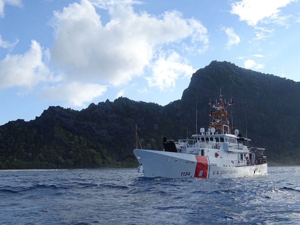
But NOAA Fisheries and the U.S. Coast Guard are urging boaters to be careful in the area of Unimak Pass so they don’t harm the whales if they’re still nearby. The area is a major transit zone for ships not just in and out of Dutch Harbor, but also to the rest of the world.
“Because they’re so critically endangered, every animal is crucial to the health of this population,” said Crance.
Also, Crance said, she hopes fishermen will continue to document the whales when they see them, and send photos and videos to Fish and Game or NOAA.
“Every sighting that we get helps put one more piece of the puzzle together to try and understand the migration and movement patterns of these animals,” she said.